
| Sl.No. | Documentation Parameters | Explanatory Notes |
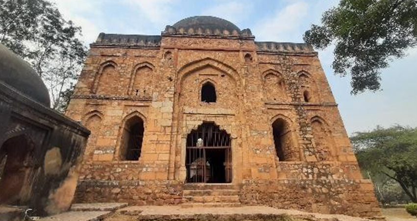
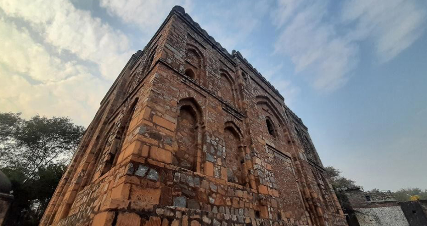
| 1. | Name of the Monument/ Site | TOMB OF BIJRI KHAN |
| 2. | Geo coordinates & Location | 28°55’ N,77°18’ E, it is located on Venkateswara Mandir Marg, R.K. Puram. Near Venkateshwara Balaji Mandir. https://maps.app.goo.gl/jYBH3wfZCtKT8fQ86 |
| 3. | Approach | Nearest Metro Station: R.K. Puram Metro Station. Nearest Railway Station: Hazrat Nizamuddin Railway Station. Nearest Bus stop: R.K. Puram Sector 2. |
| 4. | Date/ Period | Lodi Period |
| 5. | Brief History | This tomb belongs to the Lodi Period. There are multiple cenotaphs inside the tomb, but none of them has been inscribed with any name. The other tomb towards the south east side belongs to the Tughlaq period and was used as a fodder store initially, which was later on preserved by the Department of Archaeology. |
| 6. | Architectural style | The superstructure is on a square plan and is made up of random rubble masonry. The tomb has arched doorways with brackets on architraves, a typical characteristic of the Lodi period. The parapet and the drum are crowned with kanguras. The red sand stone finial on the dome is a unique feature of the tomb. |